- Home
- Car Dealer
- IGLA Immobilizer
- Anti-Theft
- Dash Cam
- Remote Start
-
Leather
-
Audio
- Driver Assist
- Accessories
-
Fleet
- SmartStart GPS-Fleet
- Viper DS4 Security-Fleet
- Viper GPS Connect-Fleet
- GPS COMMANDER Fleet
- GPS DEALER Fleet
- GPS STEALTH Fleet
- GPS-IRIS-Fleet
- Powersport GPS-Fleet
- Powersport Security-Fleet
- Dash Cam 4ch Fleet
- Dash Cam Truck-Fleet
- Dash Cam Taxi-Fleet
- Dash Cam DR750S-Fleet
- Dash Cam FA200D-Fleet
- Back Up Camera-Fleet
- Forward Camera-Fleet
- Back Up Sensors -Fleet
- Forward Sensors-Fleet
- Blind Spot-Fleet
- Lighting Fleet
GPS-IRIS $450 Installed
5 Year subscription included
Install GPSIRIS on your Dealership fleet vehicles, know where they are at all times, set parameters at the free web portal. Leave the system in the car and make a profit on the installation later by including the enabled Remote Start Cell Phone Feature when the car is sold.
- FREE Remote Start From Phone App Included (get out on the road with zero delay and a safe de-iced vehicle)
- Works Great for Dealerships or Companies with a Small to Medium Size Fleet to Monitor
- Set Your own Parameters Regarding How Your Vehicles are Been Used
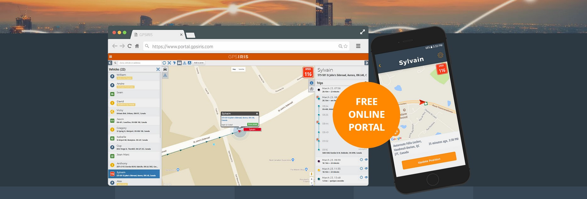
- Free Online Portal and Mobile App
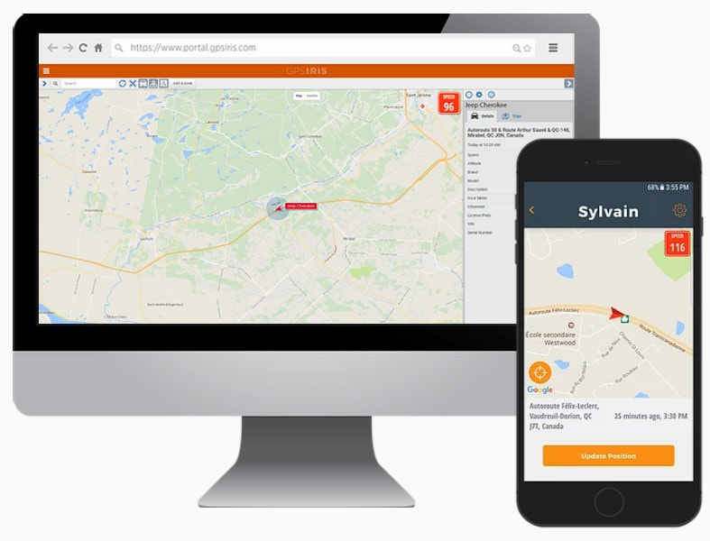
- See the Vehicles Live Location on a Map
- Set Speed Limit
- Receive Speed and Tow Alerts
- View Past Vehicle Activity
Take advantage of a complete and affordable vehicle management solution, whether it’s to keep track of one vehicle or a fleet, the GPSIRIS system has been designed to meet all your vehicle location needs.
GPSIRIS allows you to:
GPSIRIS allows you to:
- Increase the efficiency and productivity of your fleet and drivers
- Ensure the safety of your truckloads and drivers
- Recover your vehicles in no time
What Else Can GPSIRIS Do For Your Company?
|
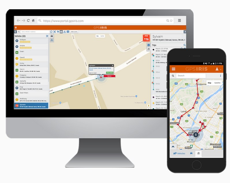
User Friendly Maps
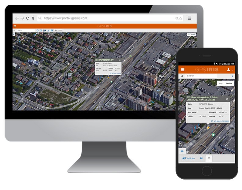
Easily scroll through the map to find the position and activity of your vehicle. The GPS IRIS portal is 100% secure and available for desktop, tablet, and smartphone. Features
|
|
Speed Alerts
Set a speed limit and get notified. Stay informed without constant monitoring. Receive a notification once a certain speed has been exceeded. Features
|
|
Geo Fencing
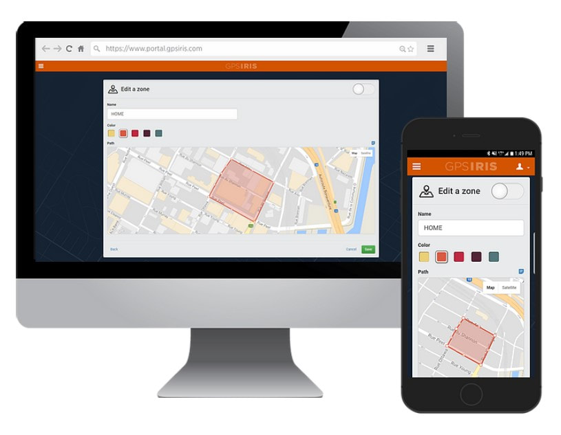
Create virtual boundaries. Create virtual parameters around a specific area on your map. Get notified if a vehicle enters or exits a specific zone. Features
|
|
History Log
View past vehicle activity, visualize where every vehicle has been at any specific time and date. See every detail along the way including location, speed, hour, and direction. Features
|
|
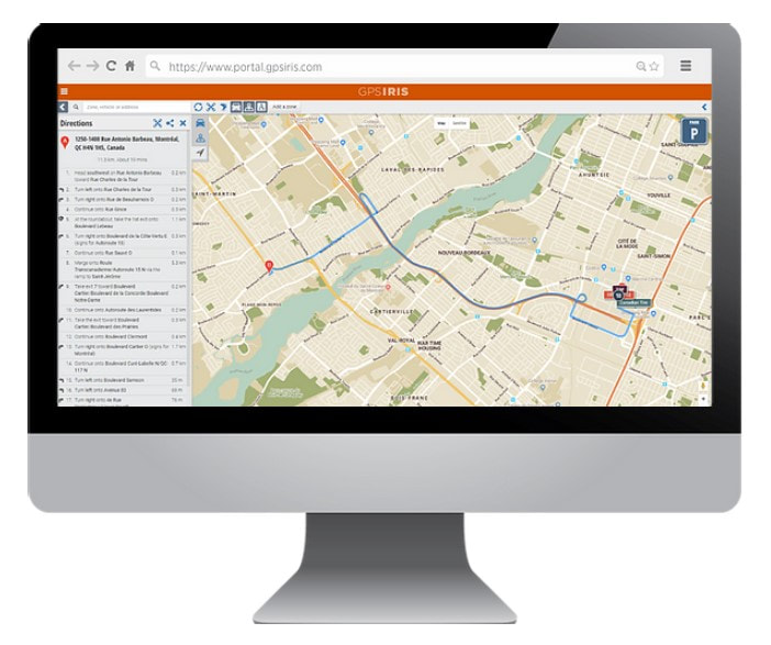
Share Directions
Share directions with your drivers, get directions to any location on the map and send the route to your drivers. Features
|
|
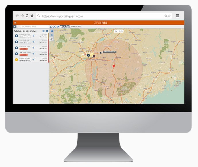
Find the Closest Vehicles
Find the closest vehicles to any point on the map. Allow dispatchers to quickly find out which vehicles are closest to a specific location or landmark. Features
|
OnSite Service
OnSite is the core of our business it allows us to provide unmatched OnSite customer service and support whether your a high volume new car dealership or a small body/glass auto repair shop OnSite has you and your customers covered
OnSite is the core of our business it allows us to provide unmatched OnSite customer service and support whether your a high volume new car dealership or a small body/glass auto repair shop OnSite has you and your customers covered
Call or Text Tracey at (905) 391-0896 Mick at (905) 718-1212 to Schedule Your Installation
Roadgear Inc 1621 McEwen Drive Unit 12 Whitby Ontario LIN9A5
Dealer Support and Service Hours: Monday - Friday 9 till 5
- Home
- Car Dealer
- IGLA Immobilizer
- Anti-Theft
- Dash Cam
- Remote Start
-
Leather
-
Audio
- Driver Assist
- Accessories
-
Fleet
- SmartStart GPS-Fleet
- Viper DS4 Security-Fleet
- Viper GPS Connect-Fleet
- GPS COMMANDER Fleet
- GPS DEALER Fleet
- GPS STEALTH Fleet
- GPS-IRIS-Fleet
- Powersport GPS-Fleet
- Powersport Security-Fleet
- Dash Cam 4ch Fleet
- Dash Cam Truck-Fleet
- Dash Cam Taxi-Fleet
- Dash Cam DR750S-Fleet
- Dash Cam FA200D-Fleet
- Back Up Camera-Fleet
- Forward Camera-Fleet
- Back Up Sensors -Fleet
- Forward Sensors-Fleet
- Blind Spot-Fleet
- Lighting Fleet

